

Having prepared the boat for passage and celebrated with homemade pizzas the evening before, we woke at 0200 on Tuesday October 18 ready to cross the Pailolo Channel. After organizing and firing up the GPS/AIS we were about to weigh anchor when we noted 2 tugs with tow entering the south end of the Pailolo heading our way. We waited about a half hour to allow them plenty of time to pass ahead of us, then pulled Rocky aboard and were underway with Yannie by 0330. Not sure how wet this passage would be, Chris disconnected the anchor from the chain and put our teak plug in the haus pipe as Shawn steered us away from Honolua under the star-filled sky and quarter moon. Up went the storm jib followed by the double reefed mains’l and we were again plowing along quietly under sail. Across the approximately 10-nm of the head of the Pailolo channel we saw ENE winds 10-15 knots and seas from the NE about 5-ft. Overall, the winds were lighter and seas were rougher than our passage across the Alenuihaha Channel, albeit much shorter.

A mere 3-hrs later, we passed a little island, Mokuho’oniki and promptly rounded Cape Halawa, the NE edge of Moloka’i. As the sun rose lighting the stark steep 2K-ft vertical green cliffs of windward Moloka’i, out of the misty clouds shrouding the 4K-ft inland peaks, Papalaua Falls appeared raging from the top of the cliffs for 1K-ft freefall. Reminding us where the water comes from, a squall down-poured on us, but quickly passed leaving amazing rainbows in its wake. Once out of the channel completely, winds relaxed and we put up the full main. We could have used more sail area forward, but didn’t want to rush, instead preferred slowly jibing our way along this magnificent sun-dappled coastline with the camera working overtime. With these steep cliffs on the rough windward side of the island, nearly continually being barraged with NE tradewinds and seas, anchorage possibilities were few and mostly rocky and steep-to (from too deep to too shallow). After about 11-nm of stunning coastline, we did pull in behind Pahu Point in hopes of finding a safe spot to drop the hook in this dramatic setting. Though beautiful, it was not quite safe enough for us in the current conditions to stay for the night, so we gaped, took pictures, and even spied a running waterfall tucked amongst the steep rocky slopes and continued on the last couple miles to our intended anchorage.


Just before noon 2-nm later, we past between Mokapu and Okala Islands, skirted behind Okala to the base of Waikolu drainage, and anchored behind steep cliffs in 25-ft of revered sand. Safely settled in this awe-inspiring, almost surreal place at the base of steep green cliffs reported to have been filmed in the opening scene of the movie “Jurrasic Park,” we sat back to observe the winds, seas, clouds, and sun as the day continued on. After a much needed nap we swam ashore to explore the floodplain and found guavas growing wild and a freshwater spring that had obviously been harnessed for human use at some point long past. We took a walk along what we dubbed as “the cliffs of insanity” as they seemed endless and overhung forming this rugged coast line. Magnificent!


The next morning, Wednesday October 19th, after a relaxing cup-o-tea surrounded by prehistoric-looking cliffs shrouded in misty clouds, we decided on our day’s adventure. We launched Fatty and loaded up with sailing rig, snorkel gear, and food and water for a journey a couple miles back east up the coast to the waterfall we had spotted on the previous day's sail. As the clouds menaced, Chris happily rowed us the arduous miles upwind and into the swell until we reached the waterfall. After watching the ocean crash into the shore, we chose to anchor Fatty off shore and swam through the surf onto the large cobble beach where a 40-ft freshwater falls, fringed with plants clinging to the cliffs, plunged into a pool and then ran over the boulders into the ocean.


We spent all day enjoying the jet of fresh water (not too much to get under, but close) shooting out of a nook in the rocks to fall into the small pool of cold fresh water. Birds were nested in the steep surrounding cliffs, tropical fish abounded just off shore, edible kukui nuts (from the Hawaiian state tree are viewed as a symbol of enlightenment, protection, and peace) similar to Brazil nuts were even deposited at the base of the falls. The sun poked through the clouds all day and we chased its rays across the beach as they fell sparingly through the slot canyon above. Just gorgeous! Alone with each other and nature, we felt very remote and moved by the spectacular scene; two ecosystems colliding, where fresh water mixes with salty sea. It was in this mystical and romantic place that Chris surprised Shawn when he pulled out a diamond ring and proposed... Yes, after 10-years, we are ENGAGED!!! Afterward, we had a rowdy downwind sail in Fatty home to Tao (with winds gusting 10-12 and 5-ft seas!), and we shared the news with Grizzly who seemed pretty ho-hum about it. We celebrated talking for hours over a bottle of Mexican white wine, watching the sun set and stars come out unhindered by any human lights, and still can’t think of a more perfect place to have spent this special time than in the isolation and beauty of the windward side of Moloka’i.


Time keeps marching on and we had to keep moving westward to stay ahead of the weather. After having spent two blissful nights at the Okala Island anchorage, we weighed anchor around noon on the 20th and enjoyed a quick sail in NE 15+ winds and 3-ft seas around the Kalaupapa Peninsula. After first anchoring in what turned out to be rocky sand, we implemented a new technique: Chris swimming until he found a good size sandy patch and Shawn motoring to it, then marking the point and dropping Rocky while Chris watched the anchor fall to the ground and finally dig in as Shawn reversed to set it. Works well in warmish clear water! We enjoyed the views from Tao since prior permission is required to set foot on the Kalaupapa Peninsula. This isolated community, which has access to the rest of the world only via an extremely steep mule trail or plane, has an extraordinary and tragic history as a former leper colony of which a few patients remain today. It is from this secluded anchorage that we sent out a shipboard e-mail to family announcing our engagement.


The next morning we weighed anchor around 0915 as the first few puffs of wind made it over the peninsula and we set our 80% jib for a downwind sail. No sooner had we gotten underway when an angry looking squall caught up, surrounded us in cloud, and dumped rain over us. We set Moni on the helm, buttoned up the boat and hid in the dry below decks while Tao got a freshwater rinse. An hour later the normal tradewinds filled in and it felt just like another day on the crossing- the only difference, the windward side of beautiful Moloka’i always within view to port. A little after 1300 we rounded the NW edge of Moloka’i and entered the Papohaku Roadstead behind ‘Ilio Point. This western edge is still quite remote with only one well hidden resort in the middle. We decided to stay N in the bay and anchored in a medium sized strip of sand off a little beach called Kawakiu Iki (“little spy place”). A late afternoon row to shore in Fatty and we found it to be a gorgeous coarse white sand beach lined with Kaiwi trees above waterline, lava edges along each side, and an exquisite reef with exposed tidal pools at the north end of the little bay. It was a speedy downwind trip back to Tao with a backdrop of beautiful cumulus clouds and sunset mostly hiding the form of Oahu a mere 30-nm across the Kaiwi Channel.


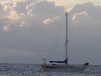

Saturday morning the 22nd, we reached a decision point. Are we going to make the extra Channel crossings to get Tao to Oahu or start our circle back eastward? A large NW swell was predicted, so pushing off the decision for a couple of days, we decided to make our way to Lono Harbor at the SW end of Moloka’i in the calm before the swell. A quick 2.5-hr motorboat ride over extremely clear waters (6-nm S along the west end then 3-nm E along the southern coast) with only a moment of discomfort rounding La’au Point over Penguin Bank, we found ourselves along in the wondrous safety of Hale-o-Lono Harbor. Originally created for barges to move sand and gravel from Molokai to Oahu, this practice was banned in 1975. Since then the harbor is more peaceful for cruisers, but has fallen into disrepair. It felt like the tiny isolated harbor, with two long breakwall fingers had been created just for us. As predicted, the next morning the NW swell rolled in and wrapped around the corner of Moloka’i to make the entrance to Lono Harbor a little bit scary. We spent 3-days here, relaxing, baking, fixing the dinged surfboard, hiking to try to find a spot of cell service, talking about how we were going to share our exciting news with all our far away friends, and overall preparing for another crossing, this time Oahu-bound.


