
Sunrise in
Lahaina on the 10th of December brought moist, windy, and rainbow filled conditions.
We constantly monitored the 6-hourly updated NOAA weather reports surrounding the unstable atmosphere and watched the rapidly changing conditions trying to make a plan. In an afternoon lull in the wind, we managed to
get to shore in time for the Saturday market in
Banyan Tree Park. While ashore we visited the Lahaina Yacht Club to check in, then went to the grocery to buy our favorite Hawaiian
style poke and sushi snacks, and finally we scoped out areas to leave Fatty and park a rental car. We were hoping
to spend a few days on the mooring, rent a car and tour some of eastern Maui
that we have not yet seen (Haleakela and Hana). Unfortunately, that night we had another poor night of sleep. The strong currents (reminiscent of La Paz, Mexico) held
us as strange angles to the wind and waves, allowing our roll stabilizer to
tangle with the mooring. When we awoke to hear that the motor boat next to us
broke free of its mooring and damaged a nearby cruising catamaran, we decided that it
was time for us to move on.
 |
| Holiday Banyan Tree |
 |
One of these dinghys doesn't look like the others.
We love Fatty!! |

After
visiting new friends on
Quixotic (whose catamaran had sustained damage from the
errant powerboat), we prepped
Tao to sail. The fickle winds vanished just as we were about to sail off the
mooring, but with our minds set on moving to a more
comfortable sleeping anchorage, we fired up Yannie and headed east. New
destination: Sugar Beach at Kihei, with back up of McGregor’s Landing if Maalaea Bay was too
rough to cross (there were 20 knot winds forecast for the day). With our full
main and 80% jib, we sailed on the inconsistent shifting winds in the lee of
the Maui West Mountains. We passed Awalua Beach anchorage, where we had spent
our 10-yr anniversary, and continued on around the point and past Olowalu. It
was at this spot on our way west that winds had screamed down the valley prompting our decision not to anchor here. This time, however, we were more prepared and dropped the full main
before reaching the slot in the mountains while sailing by. The weather felt electric. Ahead toward Maalaea Bay, conditions did not look good with the tops being blown off frothy white caps. But still determined, we continued on. However, we were quickly overpowered when we reached the gap winds. It was indeed as rough as it looked
from afar. These were not the predicted 20-knot winds, closer to 40-knots! Upon Shawn’s pleas and
knowing that we were indeed overpowered with our current configuration, Chris
jibed us and we headed back toward the safety of Awalua Beach. Unwilling to
believe that we were unable to even reach McGregor’s Landing, stubbornly Chris begged
Shawn to let us try again. With longing glances over his shoulder, he claimed it
looked like conditions were mellowing again and maybe we had just seen the leading
edge. A second attempt, however, had us quickly running back to safer conditions.


We reached
Awalua Beach just in time for the winds rushing down the 4K-ft mountains to
reach there as well. Yannie chugging away and sails down, we headed for our
previous anchor point where we knew there were expansive sandy conditions. Over
the howling winds Chris yelled “Drop the hook!” And Rocky was immediately on
the job setting without the engine. For good measure we did back down on the
anchor as we observed what the astonishingly strong winds did to
Tao at anchor. Flying dust made it difficult to look into the wind, water was being blown
off the wave tops, whirlpools of water were being sucked off the surface, and waves were already kicked up by the time they reached
Tao only 350-yds off shore. And then suddenly, it would mellow to 20-knots, only to come raging back
again clocked up to 40-knots with our anemometer. We let out nearly 7:1 all
chain scope to handle the sudden extreme gusts which continued consistently
late into the night. The NOAA forecast showed the next morning would be clear
to move, but when we awoke, the gale warning that had finally been issued was
extended and there were still lingering gusts. So we stayed put and used it as
a recovery day even though the conditions appeared to be waning. Shawn cooked
and rowed Chris into shore where he hitched a ride into town to grab a few more
food items. Tired from several nights of poor sleep, we went down with the beautiful setting sun and slept for a solid 11-hrs.
 |
| Recovery setup below decks |


Decision
point, do we stay or do we go? We decided to conservatively poke our nose out
into the edge of the channel where we figured the late afternoon winds would be
at their maximum. If it was too much, we’d turn around and happily enjoy more
time on Maui. As we left the protection of Maui around 1400, winds filled in
solidly from the E at 15-knots with seas to 4-ft. Flying along under 80% jib
alone, Shawn lobbied to turn back, pull into La Perouse and get the boat more
prepared for the crossing, then leave before the sun set. Chris lobbied to
continue on and prepare underway to make miles across the channel while the sun
was shining. Together we decided to go for it. Chris bravely went on
deck to set the jack lines and detatched the anchor in order to put the teak
plug into our haus pipe. Feeling uncomfortable, without options to reduce sail, Shawn
quickly talked Chris into a heads’l change. We dropped the jib and spent 20
uncomfortable, very wet minutes on the foredeck attaching the storms’l and
removing the 80% as we floated side to the swell. Up went the storm jib, and we
needed a little more area, so a triple-reefed mains’l quickly followed. We wanted
to point toward the north end of the Big Island (120-deg magnetic), but instead, we settled
for the southern point (150-deg magnetic) which was as high
as we could point in semi-comfort. We were being set by a strong current and it
was apparent that we were ferrying across a massive river of water squeezed between
Maui and the Big Island. By 1530, the winds were gusting to 25-knots with
seas building to 5-ft and an ominously cloudy sky. By 1700 we had lost some wind
speed, and by the time we saw the last rays of sun, seas had increased to an uncomfortable 8-ft. Five hours after entering the channel we were half way across when
the winds and seas abruptly decreased and the clouds began to break, letting
stars peek through. We raised the full main and sailed another half hour in
less than 10-knots of wind and 4-ft seas when it finally became obvious that
we weren’t really sailing, but drifting due south with the currents.
Chris voiced the option of waiting for the wind and Shawn,
still feeling exposed, barely half way across the channel, voted for the iron genoa.

Yannie to
the rescue, again. It wasn’t until the winds reduced to nothing and then
switched to the SE that we finally believed that, although still 20-nm out, we
were once again in the lee of the Big Island. We both felt that we were
being welcomed home into the safe embrace of the Big Island’s shadow. With the
engine on we were able to motor sail another 6-hrs in mostly calm conditions
with stars ablaze and phosphorescence in our wake. We watched on the AIS and
subsequently searched for lights of not one but two cargo ships barreling down
the Alenuihaha Channel at 14-knots of speed and one tug-towing-barge north of us
leaving Kawaihae Harbor at 8-knots for points west where we had been shortly before. The
quarter moon finally rose brightly but was quickly obscured by a squall that
brought a half hour heavy downpour and complete freshwater rinse for Tao. As we
approached our waypoint for Kiholo Bay we were greeted by the sweet scent of
freshly rained upon land. Although we don’t like to come into anchorages at
night, we were confident with our previous exploration and luckily dropped the
anchor right into the large patch of sand just before 0200 early Wednesday the
14th.

Our eastward journey across the Alenuihaha Channel was 50-nm, 20-nm longer than our westward
crossing much higher in the channel. If you add another 18-nm from Awalua Beach to the edge of Maui, we traveled 68-nm over 17-hrs. We are grateful to have made another safe passage
across the deservedly infamous Alenuihaha Channel, and would not like to see it in conditions any
stronger than those we saw. Although the weather window did stay open throughout the next
day, it has since slammed shut and there are currently gale conditions
(>35-knots with 17-ft seas) in the channel which are not forecast to let up until just
before the New Year. In the safety of the Big Island leeward waters, we reveled in the land of black sand and red sunsets. We spent
two gorgeous days at anchor in Kiholo Bay listening to whale blows and songs,
watching huge manta rays swimming, sailing over reefs in Fatty and exploring ashore, all the while discussing
our next options. When a space came open in Honokohau Harbor on the 16th, we
quickly made our way there to secure moorage in safe harbor for the holidays
during the dangerous
Kona-wind season. As we motorsailed south along the coast,
we watched whales and dolphins blow and dive. Once in the harbor, after topping our fuel and
talking to the DLNR office, we were welcomed by Tim of
Midnight Blue (who we last saw in Punta de Mita) on his new paddleboard as we made our way to our current home, slip
J-28.
 Sunrise in
Lahaina on the 10th of December brought moist, windy, and rainbow filled conditions.
We constantly monitored the 6-hourly updated NOAA weather reports surrounding the unstable atmosphere and watched the rapidly changing conditions trying to make a plan. In an afternoon lull in the wind, we managed to
get to shore in time for the Saturday market in Banyan Tree Park. While ashore we visited the Lahaina Yacht Club to check in, then went to the grocery to buy our favorite Hawaiian
style poke and sushi snacks, and finally we scoped out areas to leave Fatty and park a rental car. We were hoping
to spend a few days on the mooring, rent a car and tour some of eastern Maui
that we have not yet seen (Haleakela and Hana). Unfortunately, that night we had another poor night of sleep. The strong currents (reminiscent of La Paz, Mexico) held
us as strange angles to the wind and waves, allowing our roll stabilizer to
tangle with the mooring. When we awoke to hear that the motor boat next to us
broke free of its mooring and damaged a nearby cruising catamaran, we decided that it
was time for us to move on.
Sunrise in
Lahaina on the 10th of December brought moist, windy, and rainbow filled conditions.
We constantly monitored the 6-hourly updated NOAA weather reports surrounding the unstable atmosphere and watched the rapidly changing conditions trying to make a plan. In an afternoon lull in the wind, we managed to
get to shore in time for the Saturday market in Banyan Tree Park. While ashore we visited the Lahaina Yacht Club to check in, then went to the grocery to buy our favorite Hawaiian
style poke and sushi snacks, and finally we scoped out areas to leave Fatty and park a rental car. We were hoping
to spend a few days on the mooring, rent a car and tour some of eastern Maui
that we have not yet seen (Haleakela and Hana). Unfortunately, that night we had another poor night of sleep. The strong currents (reminiscent of La Paz, Mexico) held
us as strange angles to the wind and waves, allowing our roll stabilizer to
tangle with the mooring. When we awoke to hear that the motor boat next to us
broke free of its mooring and damaged a nearby cruising catamaran, we decided that it
was time for us to move on.

 After
visiting new friends on Quixotic (whose catamaran had sustained damage from the
errant powerboat), we prepped Tao to sail. The fickle winds vanished just as we were about to sail off the
mooring, but with our minds set on moving to a more
comfortable sleeping anchorage, we fired up Yannie and headed east. New
destination: Sugar Beach at Kihei, with back up of McGregor’s Landing if Maalaea Bay was too
rough to cross (there were 20 knot winds forecast for the day). With our full
main and 80% jib, we sailed on the inconsistent shifting winds in the lee of
the Maui West Mountains. We passed Awalua Beach anchorage, where we had spent
our 10-yr anniversary, and continued on around the point and past Olowalu. It
was at this spot on our way west that winds had screamed down the valley prompting our decision not to anchor here. This time, however, we were more prepared and dropped the full main
before reaching the slot in the mountains while sailing by. The weather felt electric. Ahead toward Maalaea Bay, conditions did not look good with the tops being blown off frothy white caps. But still determined, we continued on. However, we were quickly overpowered when we reached the gap winds. It was indeed as rough as it looked
from afar. These were not the predicted 20-knot winds, closer to 40-knots! Upon Shawn’s pleas and
knowing that we were indeed overpowered with our current configuration, Chris
jibed us and we headed back toward the safety of Awalua Beach. Unwilling to
believe that we were unable to even reach McGregor’s Landing, stubbornly Chris begged
Shawn to let us try again. With longing glances over his shoulder, he claimed it
looked like conditions were mellowing again and maybe we had just seen the leading
edge. A second attempt, however, had us quickly running back to safer conditions.
After
visiting new friends on Quixotic (whose catamaran had sustained damage from the
errant powerboat), we prepped Tao to sail. The fickle winds vanished just as we were about to sail off the
mooring, but with our minds set on moving to a more
comfortable sleeping anchorage, we fired up Yannie and headed east. New
destination: Sugar Beach at Kihei, with back up of McGregor’s Landing if Maalaea Bay was too
rough to cross (there were 20 knot winds forecast for the day). With our full
main and 80% jib, we sailed on the inconsistent shifting winds in the lee of
the Maui West Mountains. We passed Awalua Beach anchorage, where we had spent
our 10-yr anniversary, and continued on around the point and past Olowalu. It
was at this spot on our way west that winds had screamed down the valley prompting our decision not to anchor here. This time, however, we were more prepared and dropped the full main
before reaching the slot in the mountains while sailing by. The weather felt electric. Ahead toward Maalaea Bay, conditions did not look good with the tops being blown off frothy white caps. But still determined, we continued on. However, we were quickly overpowered when we reached the gap winds. It was indeed as rough as it looked
from afar. These were not the predicted 20-knot winds, closer to 40-knots! Upon Shawn’s pleas and
knowing that we were indeed overpowered with our current configuration, Chris
jibed us and we headed back toward the safety of Awalua Beach. Unwilling to
believe that we were unable to even reach McGregor’s Landing, stubbornly Chris begged
Shawn to let us try again. With longing glances over his shoulder, he claimed it
looked like conditions were mellowing again and maybe we had just seen the leading
edge. A second attempt, however, had us quickly running back to safer conditions.
 We reached
Awalua Beach just in time for the winds rushing down the 4K-ft mountains to
reach there as well. Yannie chugging away and sails down, we headed for our
previous anchor point where we knew there were expansive sandy conditions. Over
the howling winds Chris yelled “Drop the hook!” And Rocky was immediately on
the job setting without the engine. For good measure we did back down on the
anchor as we observed what the astonishingly strong winds did to Tao at anchor. Flying dust made it difficult to look into the wind, water was being blown
off the wave tops, whirlpools of water were being sucked off the surface, and waves were already kicked up by the time they reached
Tao only 350-yds off shore. And then suddenly, it would mellow to 20-knots, only to come raging back
again clocked up to 40-knots with our anemometer. We let out nearly 7:1 all
chain scope to handle the sudden extreme gusts which continued consistently
late into the night. The NOAA forecast showed the next morning would be clear
to move, but when we awoke, the gale warning that had finally been issued was
extended and there were still lingering gusts. So we stayed put and used it as
a recovery day even though the conditions appeared to be waning. Shawn cooked
and rowed Chris into shore where he hitched a ride into town to grab a few more
food items. Tired from several nights of poor sleep, we went down with the beautiful setting sun and slept for a solid 11-hrs.
We reached
Awalua Beach just in time for the winds rushing down the 4K-ft mountains to
reach there as well. Yannie chugging away and sails down, we headed for our
previous anchor point where we knew there were expansive sandy conditions. Over
the howling winds Chris yelled “Drop the hook!” And Rocky was immediately on
the job setting without the engine. For good measure we did back down on the
anchor as we observed what the astonishingly strong winds did to Tao at anchor. Flying dust made it difficult to look into the wind, water was being blown
off the wave tops, whirlpools of water were being sucked off the surface, and waves were already kicked up by the time they reached
Tao only 350-yds off shore. And then suddenly, it would mellow to 20-knots, only to come raging back
again clocked up to 40-knots with our anemometer. We let out nearly 7:1 all
chain scope to handle the sudden extreme gusts which continued consistently
late into the night. The NOAA forecast showed the next morning would be clear
to move, but when we awoke, the gale warning that had finally been issued was
extended and there were still lingering gusts. So we stayed put and used it as
a recovery day even though the conditions appeared to be waning. Shawn cooked
and rowed Chris into shore where he hitched a ride into town to grab a few more
food items. Tired from several nights of poor sleep, we went down with the beautiful setting sun and slept for a solid 11-hrs.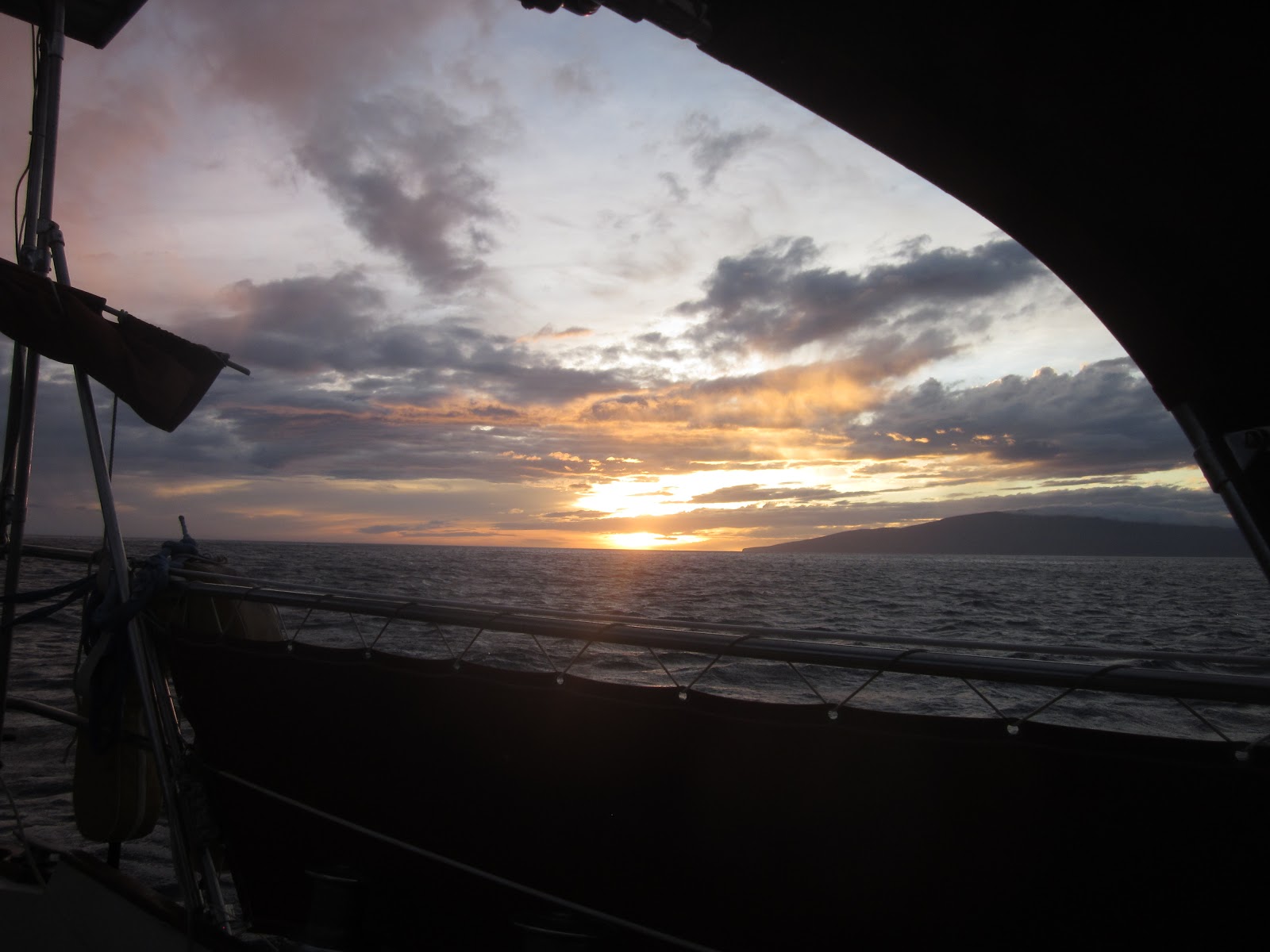


 We awoke
early Tuesday the 13th, and were underway by 0900. Surrounding conditions were
much improved and NOAA forecasts were still looking favorable (SW winds 10-15) for a Wednesday Alenuihaha Channel crossing. Slight breezes filled in
and we slowly sailed toward La Perouse, our planned jump-off anchorage on the SW edge of
Maui. It was a whale watching extravaganza. As far as we could see each
direction, there were spouts, humped backs and whale tails diving. The whales
were apparently on the move and it was magical. We made it across Maalaea Bay
by 1300 where the winds disappeared. Drifting on the currents, we turned on
Yannie to move the final few miles to La Perouse and checked the weather again.
Not surprisingly, the forecast had changed. NOAA was obviously having difficulty
forecasting with the unstable air masses aloft. The updated forecast predicted that conditions
would hold through the day (now E 15-20) and then Wednesday deteriorate to solid
20-25-knots. We could see heavy storm clouds hanging over Haleakela promising
rain, and feared that the window was closing for making comfortable safe passage
across the Alenuihaha Channel.
We awoke
early Tuesday the 13th, and were underway by 0900. Surrounding conditions were
much improved and NOAA forecasts were still looking favorable (SW winds 10-15) for a Wednesday Alenuihaha Channel crossing. Slight breezes filled in
and we slowly sailed toward La Perouse, our planned jump-off anchorage on the SW edge of
Maui. It was a whale watching extravaganza. As far as we could see each
direction, there were spouts, humped backs and whale tails diving. The whales
were apparently on the move and it was magical. We made it across Maalaea Bay
by 1300 where the winds disappeared. Drifting on the currents, we turned on
Yannie to move the final few miles to La Perouse and checked the weather again.
Not surprisingly, the forecast had changed. NOAA was obviously having difficulty
forecasting with the unstable air masses aloft. The updated forecast predicted that conditions
would hold through the day (now E 15-20) and then Wednesday deteriorate to solid
20-25-knots. We could see heavy storm clouds hanging over Haleakela promising
rain, and feared that the window was closing for making comfortable safe passage
across the Alenuihaha Channel.


 Decision
point, do we stay or do we go? We decided to conservatively poke our nose out
into the edge of the channel where we figured the late afternoon winds would be
at their maximum. If it was too much, we’d turn around and happily enjoy more
time on Maui. As we left the protection of Maui around 1400, winds filled in
solidly from the E at 15-knots with seas to 4-ft. Flying along under 80% jib
alone, Shawn lobbied to turn back, pull into La Perouse and get the boat more
prepared for the crossing, then leave before the sun set. Chris lobbied to
continue on and prepare underway to make miles across the channel while the sun
was shining. Together we decided to go for it. Chris bravely went on
deck to set the jack lines and detatched the anchor in order to put the teak
plug into our haus pipe. Feeling uncomfortable, without options to reduce sail, Shawn
quickly talked Chris into a heads’l change. We dropped the jib and spent 20
uncomfortable, very wet minutes on the foredeck attaching the storms’l and
removing the 80% as we floated side to the swell. Up went the storm jib, and we
needed a little more area, so a triple-reefed mains’l quickly followed. We wanted
to point toward the north end of the Big Island (120-deg magnetic), but instead, we settled
for the southern point (150-deg magnetic) which was as high
as we could point in semi-comfort. We were being set by a strong current and it
was apparent that we were ferrying across a massive river of water squeezed between
Maui and the Big Island. By 1530, the winds were gusting to 25-knots with
seas building to 5-ft and an ominously cloudy sky. By 1700 we had lost some wind
speed, and by the time we saw the last rays of sun, seas had increased to an uncomfortable 8-ft. Five hours after entering the channel we were half way across when
the winds and seas abruptly decreased and the clouds began to break, letting
stars peek through. We raised the full main and sailed another half hour in
less than 10-knots of wind and 4-ft seas when it finally became obvious that
we weren’t really sailing, but drifting due south with the currents.
Chris voiced the option of waiting for the wind and Shawn,
still feeling exposed, barely half way across the channel, voted for the iron genoa.
Decision
point, do we stay or do we go? We decided to conservatively poke our nose out
into the edge of the channel where we figured the late afternoon winds would be
at their maximum. If it was too much, we’d turn around and happily enjoy more
time on Maui. As we left the protection of Maui around 1400, winds filled in
solidly from the E at 15-knots with seas to 4-ft. Flying along under 80% jib
alone, Shawn lobbied to turn back, pull into La Perouse and get the boat more
prepared for the crossing, then leave before the sun set. Chris lobbied to
continue on and prepare underway to make miles across the channel while the sun
was shining. Together we decided to go for it. Chris bravely went on
deck to set the jack lines and detatched the anchor in order to put the teak
plug into our haus pipe. Feeling uncomfortable, without options to reduce sail, Shawn
quickly talked Chris into a heads’l change. We dropped the jib and spent 20
uncomfortable, very wet minutes on the foredeck attaching the storms’l and
removing the 80% as we floated side to the swell. Up went the storm jib, and we
needed a little more area, so a triple-reefed mains’l quickly followed. We wanted
to point toward the north end of the Big Island (120-deg magnetic), but instead, we settled
for the southern point (150-deg magnetic) which was as high
as we could point in semi-comfort. We were being set by a strong current and it
was apparent that we were ferrying across a massive river of water squeezed between
Maui and the Big Island. By 1530, the winds were gusting to 25-knots with
seas building to 5-ft and an ominously cloudy sky. By 1700 we had lost some wind
speed, and by the time we saw the last rays of sun, seas had increased to an uncomfortable 8-ft. Five hours after entering the channel we were half way across when
the winds and seas abruptly decreased and the clouds began to break, letting
stars peek through. We raised the full main and sailed another half hour in
less than 10-knots of wind and 4-ft seas when it finally became obvious that
we weren’t really sailing, but drifting due south with the currents.
Chris voiced the option of waiting for the wind and Shawn,
still feeling exposed, barely half way across the channel, voted for the iron genoa.


